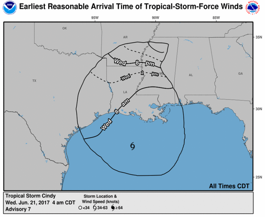
Tropical Depression Cindy continues to bring rain and some wind to northeast Louisiana. The remnants of the storm should move out of the area by the end of the weekend. Click here for the latest forecast from the National Weather Service.
FINAL BULLETIN ON CINDY -- 10 a.m. Thursday
...CINDY WEAKENS BUT HEAVY RAINS CONTINUE...
SUMMARY OF 1000 AM CDT...1500 UTC...INFORMATION
-----------------------------------------------
ABOUT 165 MI...265 KM NW OF MORGAN CITY LOUISIANA MAXIMUM SUSTAINED WINDS...35 MPH...55 KM/H PRESENT MOVEMENT...N OR 10 DEGREES AT 13 MPH...20 KM/H MINIMUM CENTRAL PRESSURE...997 MB...29.44 INCHES
WATCHES AND WARNINGS
--------------------
CHANGES WITH THIS ADVISORY:
The Tropical Storm Warning from High Island Texas to Morgan City Louisiana has been discontinued.
There are no coastal watches of warnings in effect.
For storm information specific to your area, including possible inland watches and warnings, please monitor products issued by your local National Weather Service forecast office.
DISCUSSION AND 48-HOUR OUTLOOK
------------------------------
The depression is moving toward the north near 13 mph (20 km/h), and a turn toward the north-northeast is expected later today, followed by a turn toward the northeast on Friday. On the forecast track, Cindy or its remnants will move into southeastern Arkansas early Friday, and into Tennessee later on Friday.
Maximum sustained winds are near 35 mph (55 km/h) with higher gusts. Additional weakening is forecast and the depression is expected to become a remnant low by Friday if not sooner.
The estimated minimum central pressure is 997 mb (29.44 inches).
HAZARDS AFFECTING LAND
----------------------
RAINFALL: Cindy is expected to produce rain accumulations of 3 to 6 inches with isolated maximum amounts up to 8 inches over extreme eastern Texas, Louisiana, and southern and eastern Arkansas through Friday morning. Additional rainfall amounts of 2 to 4 inches with isolated maximum amounts of 8 inches over southern Mississippi, southern and central Alabama, and extreme western Florida Panhandle are expected through Friday morning. This may bring storm total rainfall in excess of 15 inches in some isolated locations. This rainfall could cause life-threatening flash flooding in these areas.
Heavy rainfall will expand across the Tennessee and Ohio valleys today and across the central Appalachians Friday into Saturday. Rainfall amounts of 2 to 4 inches with isolated maximum amounts of 6 inches are expected through Friday morning.
WIND: Gusts of tropical storm force in a few squalls are still possible mainly to the east of the depression.
STORM SURGE: Inundation of 1 to 3 feet above ground level is still possible along the northern Gulf of Mexico coast in areas of strong onshore winds.
TORNADOES: A few tornadoes are possible through tonight from the lower Mississippi and Tennessee Valley regions to the central Gulf Coast.
NEXT ADVISORY
-------------
This is the last public advisory issued by the National Hurricane Center on this system. Future information on this system can be found in Public Advisories issued by the Weather Prediction Center beginning at 4 PM CDT, under AWIPS header TCPAT3, WMO header WTNT33 KWNH, and on the web at http://www.wpc.ncep.noaa.gov.
Tropical Depression Cindy Advisory Number 12 NWS National Hurricane Center Miami FL AL032017 1000 AM CDT Thu Jun 22 2017
Forecaster Avila


