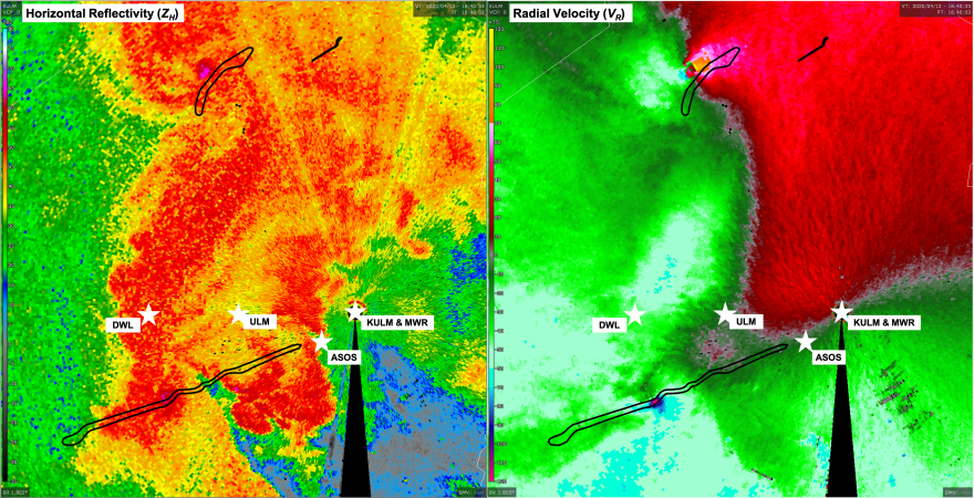
On a dark and stormy Easter Sunday in 2020, two EF-3 tornadoes ripped their way through northeast Louisiana.
A recent paper published in the National Weather Association's "Journal of Operational Meteorology" by the University of Louisiana Monroe analyzed the impact of tornados that formed on April 12, 2020, in Monroe. The event produced two EF-3 tornadoes that destroyed 23 homes and damaged 458 homes. The model used suggests a $39 million in economic savings from the expected versus actual casualty losses.
The research results found 0 casualties, including injuries and fatalities, directly attributed to the tornado. This scenario could expect at least 19 casualties, suggesting that improved low-level coverage provided by the ULM polarimetric Doppler weather radar greatly assisted the National Weather Service warning operations in issuing a better tornado warning lead time.
With tornado warnings, every minute counts.Dr. Todd Murphy
"Analysis of the 12 April 2020 Northern Louisiana Tornadic QLCS," was co-authored by Associate Professor and Atmospheric Science Program Coordinator Todd A. Murphy, Assistant Professor of Geosciences, Tyler Fricker, and university students Tessa Stetzer and Lauren Walker, along with National Weather Service meteorologists Brad Bryant and Charles Woodrum.
The paper examines the event by looking at the evolution of the pre-tornadic environment and the tornadic circulation, estimating tornado intensity using a variety of traditional and new methods, and finally applying a casualty model to the storm survey data.
"This paper shows for the first time the type of economic impact the ULM radar has for our region. The ULM data-sharing partnerships with surrounding NWS offices have led to numerous positive outcomes since the radar became operational and is a model that could be used in other radar gaps across the country," Murphy said.
Some analyses were based on UAS flights of the tornado track provided by Paul Karlowitz and Stephanie Robinson from the ULM UAS program. The full publication can be accessed via https://doi.org/10.15191/nwajom.2022.1004
Highlights from the interview with Dr. Todd Murphy:
Biggest takeaways from the paper
This is the first time we've been able to assign a dollar value to the work performed by the ULM radar. Dr. Tyler Fricker applied a casualty model that looked at a storm of this size, coming through a populated area during the Spring. For a storm like the one we saw on Easter 2020, we would normally expect 19 casualties. We had zero.
We can assign a value to each of the casualties that we didn't have, and we found that we saved, likely, about 39 million dollars. This is a team effort between the National Weather Service, broadcasters like KEDM Public radio, and the public.
A better storm view means saved lives
The ULM radar provides low-level views of storms coming through northeast Louisiana that can't be seen as well from radar sites in Shreveport and Jackson, Mississippi. National Weather Service meteorologists were clear that the tornado warning would have either come out later, or much later as damage reports started coming in. The sooner the warning comes out, the sooner people can take action to stay safe.
We're no strange to severe events. Each of these events, the early warnings are likely saving millions of dollars with warnings coming out sooner.
For these squall line tornadoes, we're able to pinpoint the tornadoes developing a little bit sooner than we thought previously, so that might help warnings come out earlier. Even three or four minutes earlier can make a difference; because with tornado warnings, every minute counts.


